Springtime is map time. The time of year I pour over lines and symbols, reading and re-reading, a favorite poem never so loved. Acquiring maps and taking the time to review them helps expand the scope of my wandering. It is also how I am able to find Quiet, Dark, & Wild car camping locations.
Maps – are the backbone of navigation, of adventure, of wandering, of a Wild Escape.
A map will help you know more and “see” more of a given area in a symbolic big picture view. Learning to read what you see on a map in relation to what you can see on the ground can help you find your way. What’s the name of that mountain? Check the map. Any place to swim? Check the map. Rut, row Rider Dog, is the road supposed to climb to the mountain top, check the map!
Expand your view, explore more, beef up your geographic trivia skills and play it safe… Get Mappy.
…But not Google. Google maps work well for urban road navigation, but more often than not, lack correct road information for public wild lands.
Visitor Use Maps:
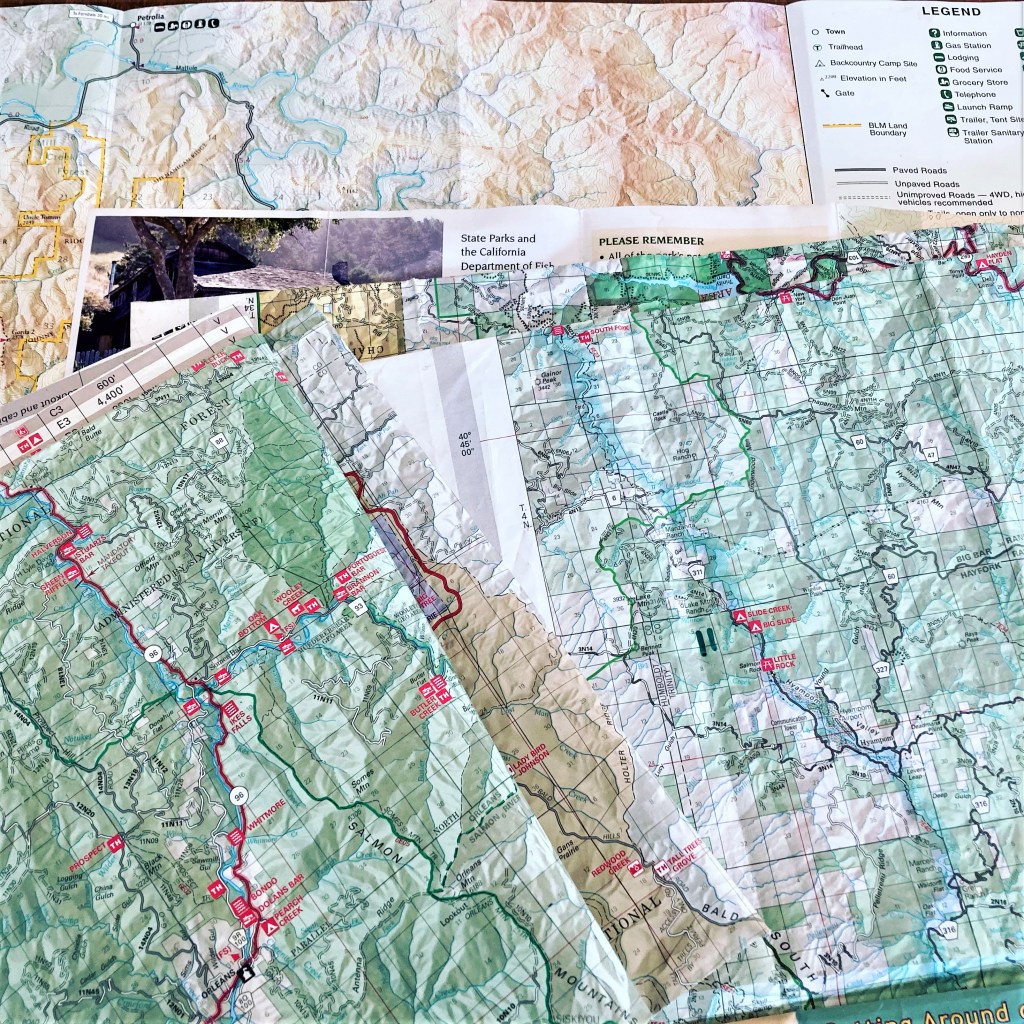
Visitor Use Maps are the most commonly used maps for visiting public wild lands. These are in depth publications that share loads of information; rules and natural history on one side and a detailed area map, including roads, on the other. All public land management agencies have this type of map for the areas they manage. The millions of acres of Public Wild Land managed by the United States Forest Service (USFS) is my favorite place to re-create, there are maps of each National Forest.
Wild Escape Guides venture deep in to the Bigfoot Country of the Six Rivers, Klamath, and Shasta-Trinity National Forests.
- National Forest Visitor Map: These maps cover extremely large areas, entire national forests, thousands of acres each. They are loaded with information: roads, boundaries, special uses, closures, campgrounds, etc. This can seem overwhelming at first glance, stick it out, it’s worth it! I find this map essential to have for any exploring in a National Forest.
- National Forest Motor Vehicle Use Map (MVUM): The MVUM identifies roads and trails open to vehicle use; and designated use class (OHV, motorcycle, etc.). These maps literally show only the roads, very few land features. National Forests are dissected by miles of roads, many roads and all the land (unless designated) have strict use policies and are not open to all types of vehicles.
(Wild Escape Guides Car Camping Bigfoot Country also enter the edge of the Bureau of Land Management King Range National Recreation Area.)
Getting [Your Hands] on a Map:
Paper Maps (yes, I said paper!): paper versions of these maps are available to purchase (under $20) from the managing agency local field offices, or on-line via managing agency web site (look for Map/Publication toggle on left side bar). National Forest maps can also be found on-line at the United States Geographical Survey (USGS) map store. Many regional Outdoor stores also carry these maps.
A testimonial for paper maps – Easy to retrieve - look at anytime, anywhere. Provides big view of the area it covers. Can be folded any way you choose. You can write on it. Using it does not require a power source, connectivity and/or your face in a screen. It could be a blanket in an emergency. They make interesting conversation - table cloths!
(most of these maps are actually plastic coated for water resistance, but you get the idea)
Digital Maps: Digital versions for most of these maps are also available for download onto your mobile phone. If you feel confident that you can keep your phone charged (GPS use/map viewing drains batteries fast), and don’t mind a small size view of a large area this may be the choice for you.
In order to use your phone for navigation you will need:
- BEFORE you go, to download a GPS Navigation App on to your phone. These Apps use the GPS in your phone via satellites, cellular connection not required. (I like Avenza. The Avenza mobile phone App is free and easy to use. Downloads for numerous maps are available at no cost. These maps are interactive (zoom in and out), a few are geo-referenced (pin point your location in real time). Avenza also lists latitude and longitude and provides a directional compass).
- BEFORE you go download and save, in the App, the area map of your choice (Name of National Forest easy place to start search). Note: topographical maps are best suited for trekking on foot.
There is no cell service throughout most of the public wild land in this region and the west – Trust me – get comfortable NOT using Google Maps!
Hand held GPS devices work ok (equipped with the appropriate SIMS map data disk card. But the road type (quality) and road closures are not delineated on these maps. Do not trust this as your only source for public wild land road information.
I hope this little tutorial helps demystify acquiring Public Wild Land Maps. Take this information, get your self a map (or two); read it at home, and read it while venturing out on a wild escape!

One thought on “Getting you [OUT] there:”